Grab Your Swimsuit and Sunglasses
We're Ready to Welcome You

Dana Point, the picturesque gateway to Southern California, is a place where laid-back beach vibes and luxury meet in one idyllic surf town. Whether you decide to get to Dana Point by car, plane, train, boat or bus, Dana Point offers visitors year-round access to its pristine beaches and seaside resorts.
Directions to Dana Point
Nestled directly between Southern California’s largest cities – Los Angeles and San Diego – this Orange County destination can be easily accessed from several major airports.
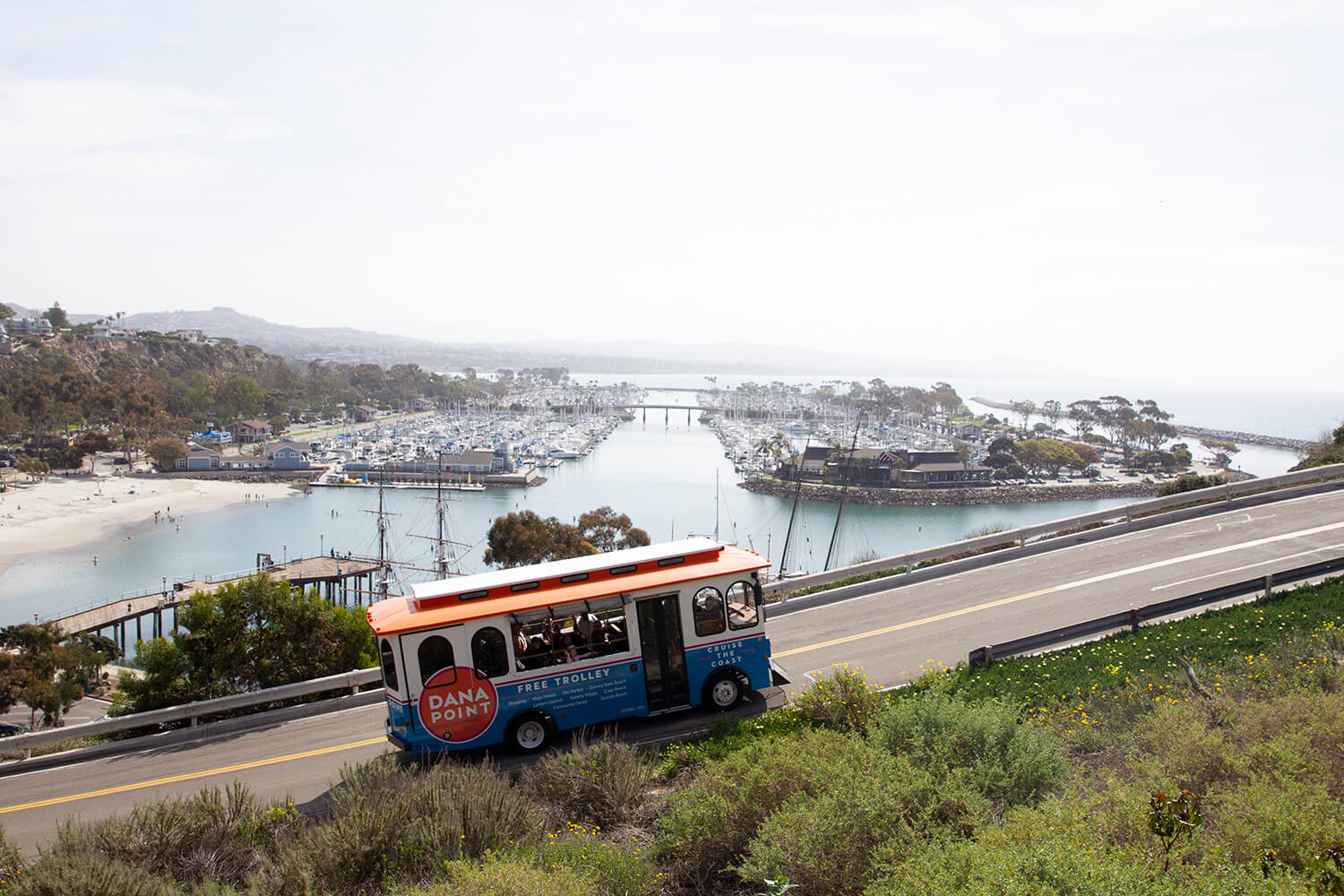
I-5 is the primary north-south route through Orange County and passes through the eastern portion of the city, making getting to Dana Point by car a breeze. State Route 1 begins in Dana Point and continues northwest through the city to other coastal Orange County towns and attractions. Those who prefer to travel by train or bus will be happy to hear that both Amtrak and Metrolink service nearby San Juan Capistrano and San Clemente. From there, you can Uber or take the Dana Point Trolley into town.
Flying to Dana Point
With the recent upgrades to Dana Point’s nearest airport, John Wayne Airport (SNA), and five other airports within 100 miles of Dana Point, it’s never been easier to fly to Southern California. From John Wayne Airport, it’s a nearly traffic-free, 25-minute drive down CA-73 to Dana Point. Most rental car companies tie the license plates to a toll transponder, making it seamless for you to get from the airport to the ocean. No searching for spare change to pay a toll!
Book using your favorite airlines through one of these major international airports:
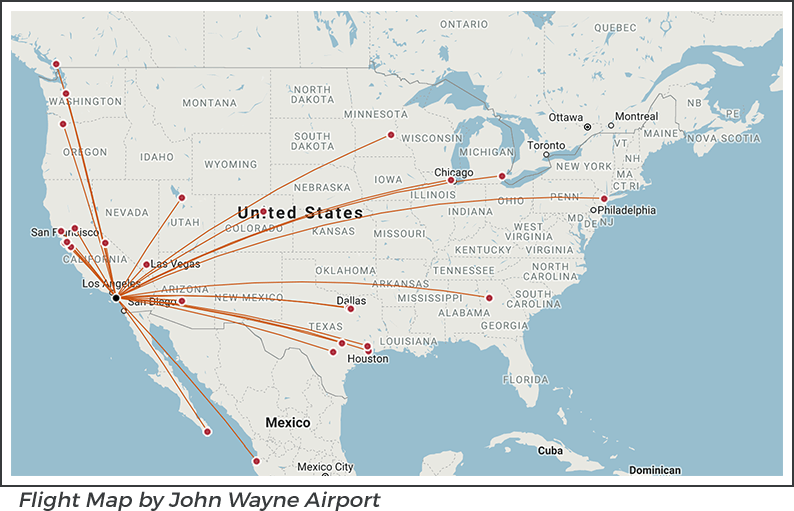
- John Wayne Airport, Orange County (SNA)
- Los Angeles International Airport (LAX)
- LA/Ontario International Airport (ONT)
- Long Beach Airport (LGB)
- San Diego International Airport (SAN)
- Palm Springs International Airport (PSP)
Directions to Dana Point by Car
Easily accessed from north, south and east (hopefully, you aren’t driving from the Pacific Ocean) via the San Diego (5) Freeway or Pacific Coast Highway, directions to Dana Point by car are quick and painless.
From Los Angeles: Take the I-5 South to exit 79/CA-1. Once you’re off the freeway, you’ll find yourself almost immediately at Doheny State Beach. Seriously, the ocean is right there when you get off of the exit.
From San Diego: Take the I-5 North for 61 miles to exit 79/CA-1 towards the Pacific Coast Highway. Boom! You’re in Dana Point.
Distances to Dana Point:
From Laguna Beach – 7 miles
From Newport Beach – 19 miles
From Huntington Beach – 29 miles
From Carlsbad/Legoland – 35 miles
From Anaheim/Disneyland – 39 miles
From Long Beach – 39 miles
From San Diego Wild Animal Park – 58 miles
From San Diego/Sea World – 61 miles
From Los Angeles – 65 miles
From Universal Studios – 68 miles
From San Diego Zoo – 68 miles
From Rodeo Drive/Beverly Hills – 70 miles
From Palm Springs – 105 miles
Directions to Dana Point by Train
Enjoy the California landscape when you access Dana Point by bus or train. Take the Amtrak and Metrolink to the nearby San Juan Capistrano Amtrak/Metrolink station. This is one of Amtrak’s most unique depots, as passenger areas are housed in vintage boxcars. They sit next to the historic, Mission Revival-style Santa Fe depot built in 1894. You can also get off the train in San Clemente. Both are just minutes down the road from Dana Point. You can easily take a taxi, Uber, Lyft or trolley right down to the beach!